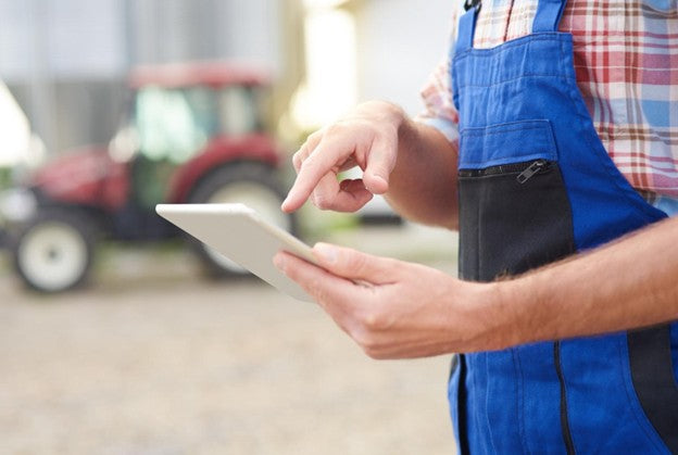
Traditionally, farm management relied on memory, paper logs, and physical inspections. But the pace of modern challenges, including extreme weather, crop stress, and labor gaps, demands a new model. Today’s farmers need more than observation. What they need is insight, delivered quickly and accurately.
Mobile apps are now central to this shift. By providing NDVI imagery as interactive maps, along with weather forecasts and field analytics, an agriculture software company can deliver satellite insights straight to a farmer’s phone – helping them monitor crop health, identify water stress areas, and make smarter, faster decisions in a rapidly changing world.
Why Farmers Are Turning To Mobile Farm Management Tech
Modern farming demands fast responses to challenges that can appear overnight. Sudden storms, floods, or heat waves interrupt fieldwork and damage crops; pests and diseases spread unseen to strike when least expected. Many farms also face labor issues: fragmented communication and poor task coordination leave jobs unfinished. Add to this the tight budgets for seeds, fertilizers, and pesticides. Even access to reliable market or agronomic advice is often delayed, leading to missed opportunities.
Mobile apps offer farmers, particularly smallholders, a way to stay connected to the information they need without delays. Instead of relying on guesswork or scattered reports, everything from weather alerts to crop conditions can be viewed on the go. What agricultural software brings to the table:
● real-time weather forecasts and alerts keep farmers ahead of rainfalls or dry spells;
● remote crop monitoring with satellite images shows changes in plant health early;
● field activity logs and zone management help track what was done and where;
● timely anomaly alerts warn of stress, pests, or disease before they spread;
● better communication connects workers and agronomists for quick decisions.
In the next section, we will go deeper into the topic of digital tools for remote crop management and examine which features enable us to fully harness these advantages.

Key Features Farmers Look For In Crop Management Apps
When farmers choose a mobile app to manage their fields, they look for tools that simplify daily routines and support better decisions. An app should not overload users with complex steps, but instead give help in any working condition. Farmers look for:
● Easy navigation and offline access. Farmers need simple menus, large buttons, and readable text that can be used outdoors. Offline access is critical in rural areas, so data must be stored locally and synced automatically once the internet returns.
● Integration of satellite vegetation indices. Access to NDVI, NDRE, and other vegetation indices lets farmers see crop health and stress on a map. This provides a quick view of where attention is needed without walking every row.
● Customizable fields and crop tagging. Drawing exact field boundaries and marking crop types helps keep records accurate. It also makes recommendations more relevant to each field.
● Task scheduling and records. Crop management software that allows planting, fertilizing, or spraying dates to be planned and logged, thus keeping operations better organized and workload optimized. Historical data helps track what worked well in past seasons.
● Compatibility with farm systems. Smooth connection with equipment and sensors saves time, allows for more precise field operations, and turns the app into a hub for farm data.
Farmers value apps that help them manage their fields efficiently, using satellite data and automation tools integrated seamlessly with existing equipment, all while respecting the challenges of rural and remote areas.
EOSDA Crop Monitoring: Farming From Your Pocket
EOSDA Crop Monitoring puts farm data where you are, on your phone, so you can always watch crops grow from afar. This precision agriculture software turns satellite images, weather, and farm history into maps you can easily read and act on:
● Index-based maps bring crop status into view. They show crop stress, pests, weeds, or disease early, so you can respond fast.
● Weather and history view offers a 14-day forecast plus long-term weather patterns for optimized timing of spraying, irrigation, and other field activities.
● VRA map builder creates zones for variable-rate seeding or fertilization based on your satellite and yield data.
● Scouting feature connects the dots in the field: assign someone to inspect a flagged area, share photos and notes, even work offline on your phone, and sync later.
● Team management organizes who does what. You can invite members, restrict access by field or role (owner, scout, observer), and track who’s active and completing tasks.
● John Deere integration imports boundaries and field activity data directly from your account, without manual entry.
So, instead of keeping notes in different places, everything ends up in one app. It makes day-to-day farming decisions clearer and less of a guessing game.
The Future Of Mobile-First Farming
Wider internet access and growing smartphone adoption are bringing mobile-first digital farming solutions within most farmers’ reach. In the near future, a farmer walking through rows of crops may carry a full farm management system in their pocket – a map, a weather station, and lab analysis all accessible through a single device. Mobile apps will gather data from soil sensors, monitor crop health via satellite imagery, and automatically schedule tasks. Interfaces will remain clear and intuitive, highlighting what requires attention without overwhelming the user with raw data.
AI will anticipate stress patterns and predict issues before they escalate, while voice input will let farmers record observations hands-free. Even in areas with unstable connectivity, precision farming software will capture and store data offline, syncing automatically once a connection is available. Mobile-first farming promises to narrow the digital gap, giving all farmers direct access to timely, actionable insights.


